

Comments from the public are being sought on a comprehensive strategy for improving the park’s trail system. The public comment period on the Chattahoochee River National Recreation Area Comprehensive Trails Management Plan / Environmental Assessment through April 30. A previous round of public comment in Spring 2021 helped inform the development of the plan and environmental assessment.
“We are pleased to offer this opportunity for the public to provide additional input on the future of the park’s trail system,” said Superintendent Ann Honious. “We’ve used what we have heard from our past outreach and designed a trail system that should be more sustainable, more enjoyable, and better connected to neighboring trails. Now, we are requesting final feedback from the public and our stakeholders on this effort.”
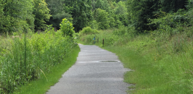
The National Park Service’s comprehensive trail plan is designed to better integrate existing trails with surrounding parks and trail networks while addressing problems of erosion, stormwater management, and environmental damage.
The plan proposed would increase the mileage of trails from 66.9 to 99.3, and standardize access points and signage.
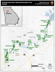
Unlike many National Park Service (NPS) locations, the Chattahoochee River NRA consists of 15 separate units from Bowmans Island, just south of Lake Lanier, to Cochran Shoals and Palisades in Cobb County. With the disconnected units and prevalence of unofficial and unmonitored trails, the NPS hasn’t had much of a unified plan for the corridor.
Under the new framework, the park service would spend about $9.6 million over the next 20 years on restoration and construction projects. Cochran Shoals and the Palisades would both see new trail networks, while closing off some existing trails to allow for wildlife rehabilitation. In the long run, the plan indicates that a pedestrian bridge spanning the river between the east and west Palisades could come forward.
“Visitors to Cochran Shoals would experience a fun, social, fitness-oriented trail system throughout the unit,” the report says. “The trail system would feel welcoming to a wide diversity of visitors with varying ability levels and would function as an urban backyard for frequent visitors.”
The plan also would account for the envisioned Chattahoochee RiverLands Greenway, a 125-mile continuous trail from the Buford Dam to Chattahoochee Bend State Park in Coweta County.
Park goers and residents can download the plan, review associated documents, and provide feedback here.
Written comments may also be submitted by mail to:
National Park Service
Denver Service Center
Attn: CRNRA Trails Plan / Charles Lawson
12795 West Alameda Pkwy
Denver, CO 80228
Written comments on the plan must be submitted online or postmarked by April 30, 2022, to be considered.


